Kamikochi: The Car-Free Valley in the Japan Alps, From Taisho-ike to Tokusawa
The overnight bus from Shinjuku pulls into the Kamikochi Bus Terminal at 5:20, and for about an hour after that the valley belongs to whoever got off it. I walked the 300 metres to Kappa-bashi in the half-dark with frost on the handrail and nobody else on the bridge. The Azusa River underneath was so clear that the stones on its bed looked an arm’s length away, and the top of the Hotaka ridge was turning pink. By ten o’clock the same bridge had a queue for photographs.
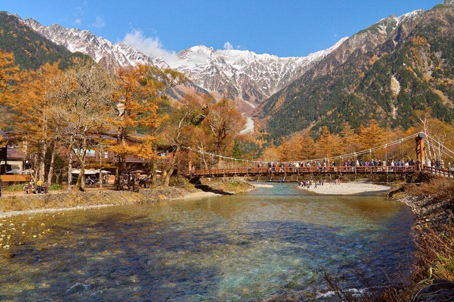
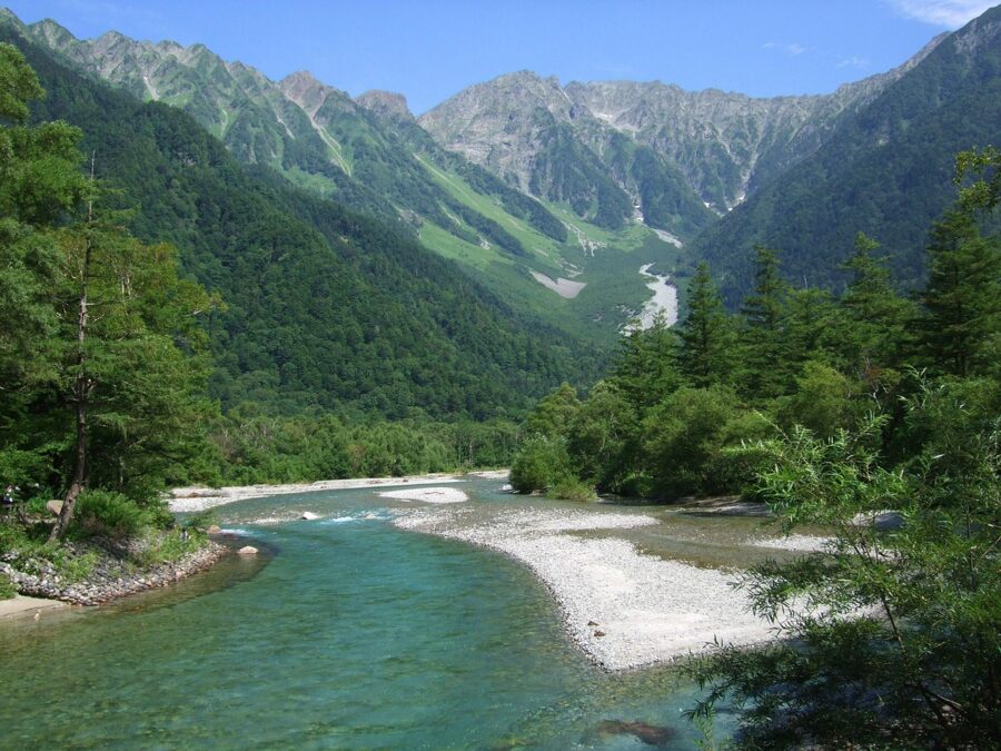
That gap between the first hour and the rest of the day is the whole trick of Kamikochi. It is a flat, high valley in the Northern Japan Alps, about 1,500 metres up, with a clear river, a volcano at one end and a wall of 3,000-metre peaks at the other. You can walk most of it in trainers. You cannot drive into it, it shuts completely for five months a year, and on an October Saturday it can feel like half of Japan arrived on the same bus as you.
So this guide is about getting the valley at its best: which bus, which bank of the river, what time to be where, and when an overnight stay is worth it (almost always). It covers the flat walks from Taisho-ike to Tokusawa, the shrine pond at Myojin, the bear rules, and where to sleep and eat. It does not cover the summits.
Here are the walks at a glance. Times are the official ones from the Kamikochi tourism association, which works on a pace of about 3 km an hour and doesn’t count stops.
| Walk (one way) | Distance | Time | Best for |
|---|---|---|---|
| Taisho-ike to Kappa-bashi, right bank via Tashiro-ike and the Weston relief | 3.8 km | about 75 min | First-timers, morning light on the ponds |
| Kappa-bashi to Myojin, right bank via Dakesawa marsh | 3.0 km | about 60 min | The Hotaka view, fewer people |
| Kappa-bashi to Myojin, left bank via Konashidaira | 2.5 km | about 50 min | The quicker way back |
| Myojin to Tokusawa | 3.0 km | about 60 min | Meadows, soft-serve, the Mae-Hotaka face |
| Tokusawa to Yokoo | 3.5 km | about 70 min | Only if you are fit and started early |
In This Article
- What Kamikochi actually is
- The gods’ enclosure
- Why it shuts for five months
- No cars, which is the point
- Getting in: trains, shuttles and the long-distance buses
- From Matsumoto: the Kamikochi Line and the bus
- Driving: Sawando and the shuttle
- From Takayama and Hirayu
- Direct buses from Tokyo and Osaka
- Passes worth knowing
- If you only have a day from Tokyo
- Taisho-ike to Kappa-bashi
- Taisho-ike
- Tashiro-ike and the marsh
- Walter Weston and the relief
- Kappa-bashi
- The walk to Myojin
- Dakesawa marsh
- Myojin-ike and the inner shrine
- Kamonji and his hut
- On to Tokusawa
- Bears, monkeys and the weather
- Bears
- Monkeys and ducks
- Weather and what to wear
- Where to sleep in the valley
- The Kamikochi Imperial Hotel
- By the bridge
- Up the valley
- Camping
- What to eat
- Iwana at Kamonjigoya
- The hotel curry
- Apple pie, soft-serve and kappa-yaki
- Shinshu soba on the way
- When to go
- A day in Kamikochi, timed
- An overnight, which is what I’d do
- Norikura, Shirahone and the Shinhotaka Ropeway
- What it costs
- Skip this
What Kamikochi actually is
Strip away the hotels and Kamikochi is a sediment plain. The Azusa River once drained west into what is now Gifu; volcanoes in the Yakedake group blocked it, a lake formed, and the river slowly filled the lake with gravel. What’s left is a strip of flat ground about 10 km long from Taisho-ike to Yokoo and up to 1 km wide. Japan has very few places this level at this height.
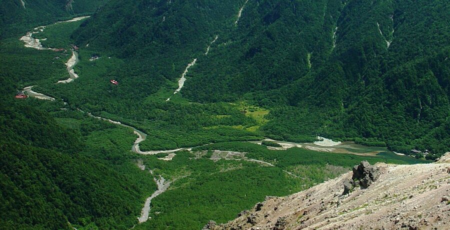
The whole valley sits inside Chubu-Sangaku National Park, created on 4 December 1934. In 1952 it was also named a Special Place of Scenic Beauty and a Special Natural Monument, a double title that only a handful of places in Japan hold. Around 1.2 million people a year come now, nearly all of them between late April and mid-November.
The gods’ enclosure
The name is older than the kanji used for it today. Kamikochi was first written 神垣内, roughly “the enclosure of the gods”, because Hotakami-no-mikoto, the deity of Hotaka Shrine, is said to have come down onto the Hotaka peaks and is worshipped beside the pond at Myojin. The modern spelling 上高地, “the high land above”, is a later sound-alike that stuck.
For most of its history the valley was a workplace, not a view. Woodcutters cut timber here for the Matsumoto domain from the 1600s and floated it down the Azusa. A summer cattle ranch ran from 1885 at Konashidaira, Myojin and Tokusawa until the national park closed it in 1934.
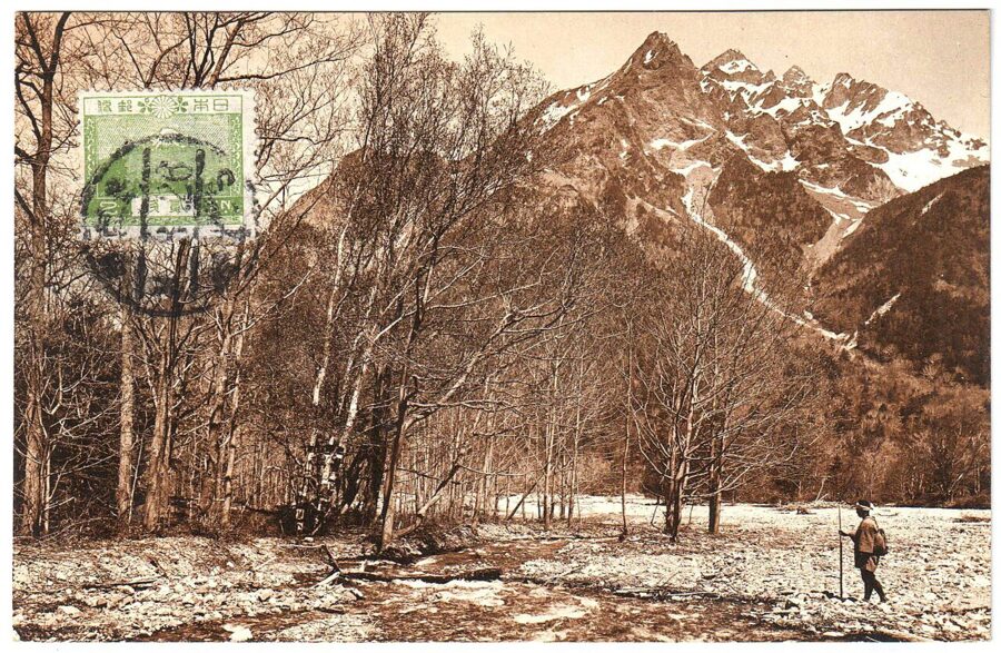
Then the outside world arrived. Akutagawa Ryunosuke set his 1927 novel Kappa at the bridge, the same year a newspaper poll picked Kamikochi as the finest valley in Japan. The Imperial Hotel opened in 1933. Before the road, you walked in from Shimashima over Tokugo Pass to Myojin, the route of Weston’s generation; a proper trail over it was only built in 1916.
Why it shuts for five months
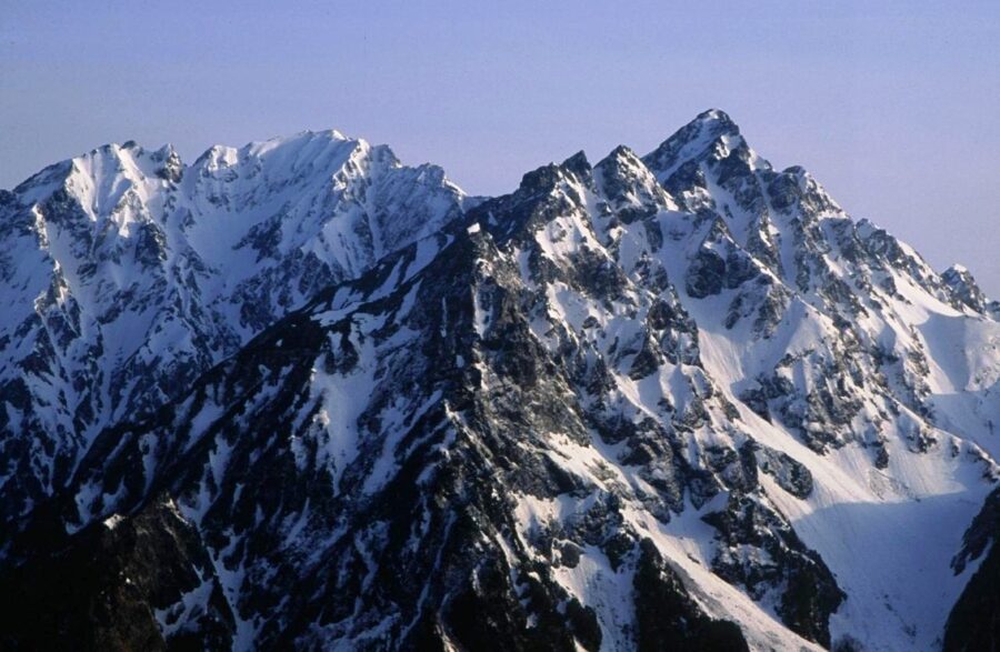
From 16 November to mid-April there are no buses or taxis, and apart from a few inns that open over New Year, nothing is open. January averages around −7.7°C on the valley floor, and the road through the Kama Tunnel is closed to everything but people on foot who have filed a climbing plan at the Nakanoyu gate. Winter entry is treated as winter mountaineering, at your own risk.
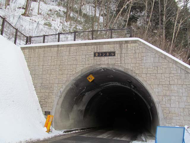
The 2026 season ran from 17 April to 15 November. The official winter notice says the closure lasts until 16 April 2027, so the road and buses open again on Saturday 17 April 2027. The opening festival is always on 27 April at Kappa-bashi, with an alphorn, a Shinto rite and a lion dance. The closing ceremony is on 15 November by the same bridge.
Plan around the facilities, not just the road. Many inns and cafés open later than the buses and shut before the closing ceremony: in 2026 Kamonjigoya stopped serving food on 10 November.
No cars, which is the point
Private cars, rental cars and motorbikes cannot pass the Kama Tunnel, at any time of year. The ban started in 1975 for the summer months and became year-round in 1996. If you drive, you park at Sawando on the Matsumoto side (¥800 a day) or at Akandana near Hirayu on the Gifu side (¥600 a day) and take a shuttle bus or a fixed-fare taxi. Both car parks charge again after midnight, so an overnight stay costs two days.
The gate at Nakanoyu opens at 5:00 and closes at 19:00 (20:00 in July and August). After that, anyone still in the valley is staying the night.
Getting in: trains, shuttles and the long-distance buses
Every route ends at the bus terminal by Kappa-bashi, and goes through one of three places: Shin-Shimashima station on the Matsumoto side, the Sawando car parks, or Hirayu on the Takayama side.
From Matsumoto: the Kamikochi Line and the bus
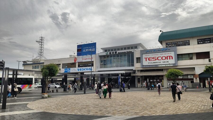
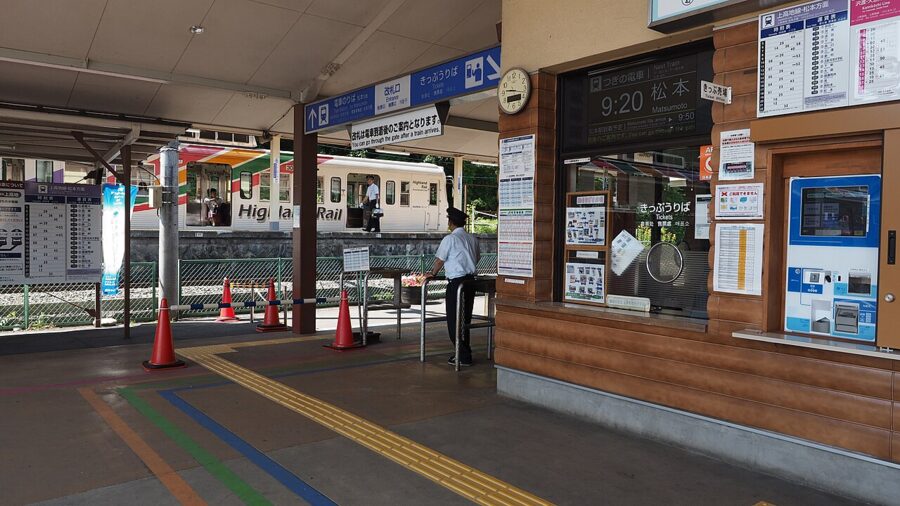
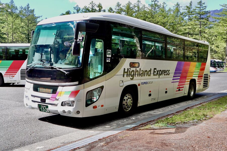
The standard route is two pieces of Alpico. The Kamikochi Line train leaves from platform 7 inside JR Matsumoto station, with no ticket gate between it and the JR platforms; you buy the ticket at the JR machines and hand it in at the JR gate when you come back. It takes about 30 minutes to Shin-Shimashima and costs ¥710.
At Shin-Shimashima you walk across to the bus. The ride up the Azusa gorge to Kamikochi takes about 65 minutes and costs ¥3,100 one way. The buses are reservation-priority: booked passengers board first, and anyone else only if there’s space. Bookings open at midnight one month before the travel date.
The return matters more than the way up, because afternoon buses down fill first. Since 1 September 2026 the stops between Kamikochi and Sawando Ohashi are also boarding-only on the downhill run. Book both directions at once.
There’s also a direct bus, the National Park Liner, from Matsumoto Bus Terminal by the station. In 2026 it left at 5:30 and 10:15 and took about an hour and a half; the fare was ¥4,600, or ¥5,000 on the 5:30 including a ¥400 early-morning surcharge. Train plus bus costs ¥3,810, so you pay a little extra to skip the change.
Driving: Sawando and the shuttle
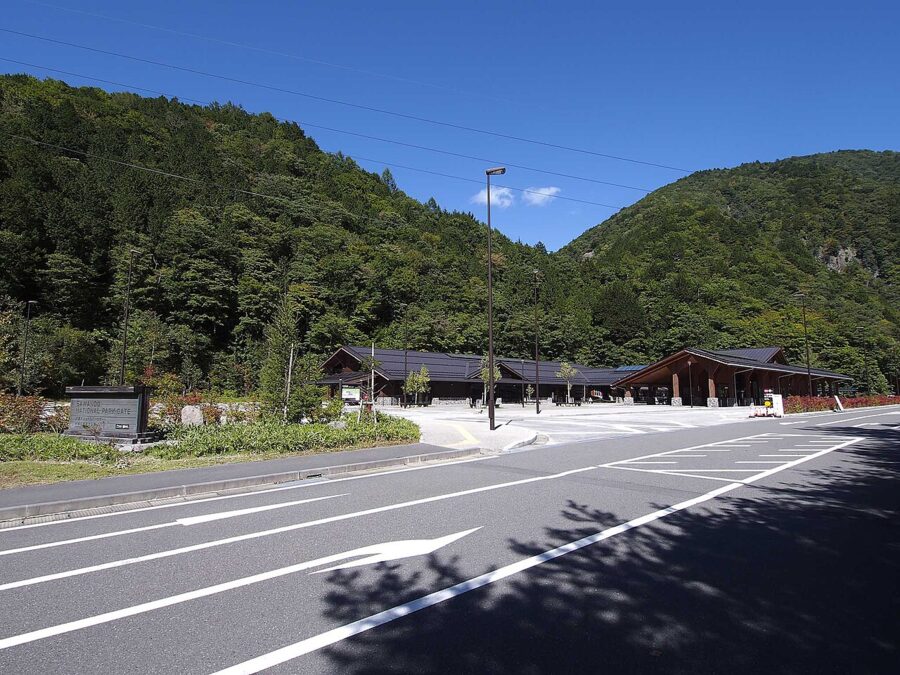
Sawando is a string of car parks below the Kama Tunnel, about 2,000 spaces in all. The hub is the National Park Gate building, with a bus terminal and an information desk. The shuttle to Kamikochi takes about half an hour and costs ¥1,600 one way or ¥3,000 return.
If there are four of you, look at the taxi. Kamikochi taxis run on fixed fares: in 2026 a standard taxi from the upper Sawando zone cost ¥5,400 to the bus terminal, ¥5,100 to the Imperial Hotel and ¥4,200 to Taisho-ike. Split four ways that’s close to the bus fare, with no queue. The last taxi up leaves at 18:00.
From Takayama and Hirayu
From the Gifu side the route runs through Hirayu Onsen. Nohi Bus takes about an hour from the Takayama Nohi Bus Center to Hirayu (¥1,600), and from Hirayu the shuttle into Kamikochi takes about 25 minutes (¥1,500 one way, ¥2,800 return). If you’ve spent the night in Takayama, this is the easy way in, with Matsumoto as the next stop out.
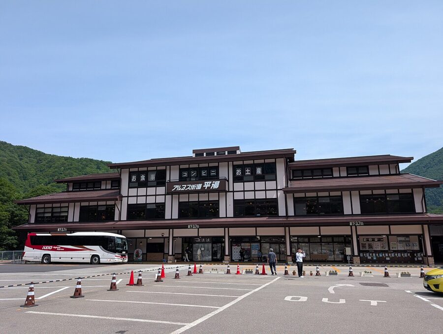
Drivers on this side park at Akandana, ten minutes up the road from Hirayu by bus. In 2026 the shuttles ran every 30 minutes, from 4:50 on the busiest days, and the last one down from Kamikochi left at 17:30. Tickets up are sold on the day only.
Direct buses from Tokyo and Osaka
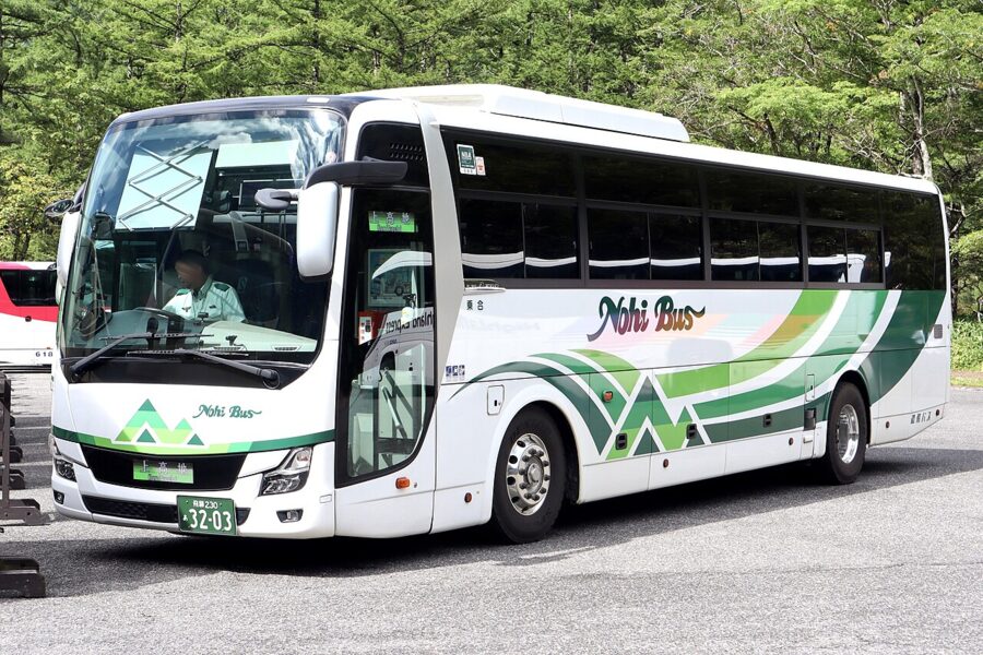
Alpico’s Sawayaka Shinshu buses run straight to the Kamikochi terminal with no changes. In 2026 the day bus left Busta Shinjuku at 7:15 and arrived at 12:02, and the overnight left at 22:25 and arrived at 5:20. Back to Shinjuku, buses left at 14:30 and 15:50 (plus 16:50 on set days), taking just under five hours.
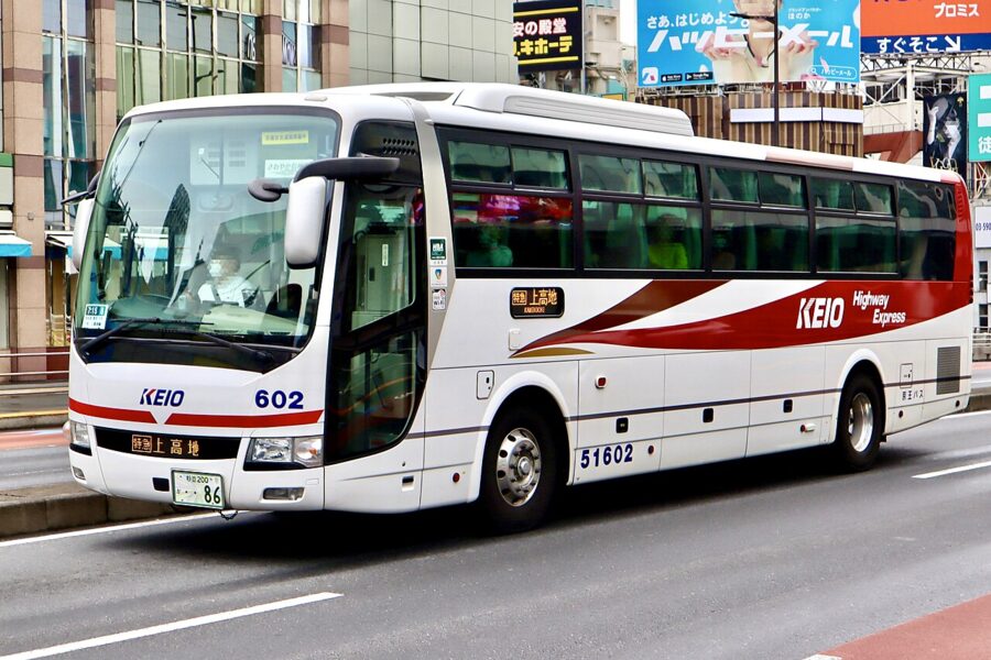
From Osaka, the Sawayaka Shinshu leaves the Hankyu Sanbangai terminal at 7:30 (arriving 13:35) or 21:30 (arriving 5:20), via Shin-Osaka and Kyoto. There are also once-daily buses from Tokyo Station, from Nagano station and from the Meitetsu Bus Center in Nagoya.
Passes worth knowing
The best one is on the Gifu side. Nohi’s Kamikochi and Okuhida Marugoto Value Ticket bundles unlimited Nohi buses between Takayama and the Shinhotaka Ropeway, one ropeway ticket and a return between Hirayu and Kamikochi. In 2026 it cost ¥10,500 for two days or ¥11,000 for three from Takayama, and ¥8,200 for two days from Hirayu. If you want the ropeway and Kamikochi on one trip, it pays for itself.
For a one-way crossing there’s the Shinhotaka and Kamikochi Trekking Ticket: Hirayu to the ropeway, the ropeway up, and Kamikochi to Hirayu, plus a ¥500 voucher, for ¥4,500 (valid 1 July to 31 October in 2026). On the Alpico side, skip the ¥1,420 Kamikochi Line day pass unless you plan to stop along the line: it costs exactly two single fares.
If you only have a day from Tokyo
It can be done, but each way is four and a half to five hours, which is why Hakone and Nikko are the usual mountain day trips from the capital. The version I’d do is the overnight Sawayaka Shinshu: leave Shinjuku at 22:25, sleep badly, walk to Myojin in the empty morning and take the 14:30 or 15:50 home. That’s eight or nine hours in the valley.
By train, sleep in Matsumoto the night before. Riding an early Azusa out of Shinjuku and coming back the same evening leaves you roughly four hours in the valley, most of it at midday when it’s busiest.
Taisho-ike to Kappa-bashi
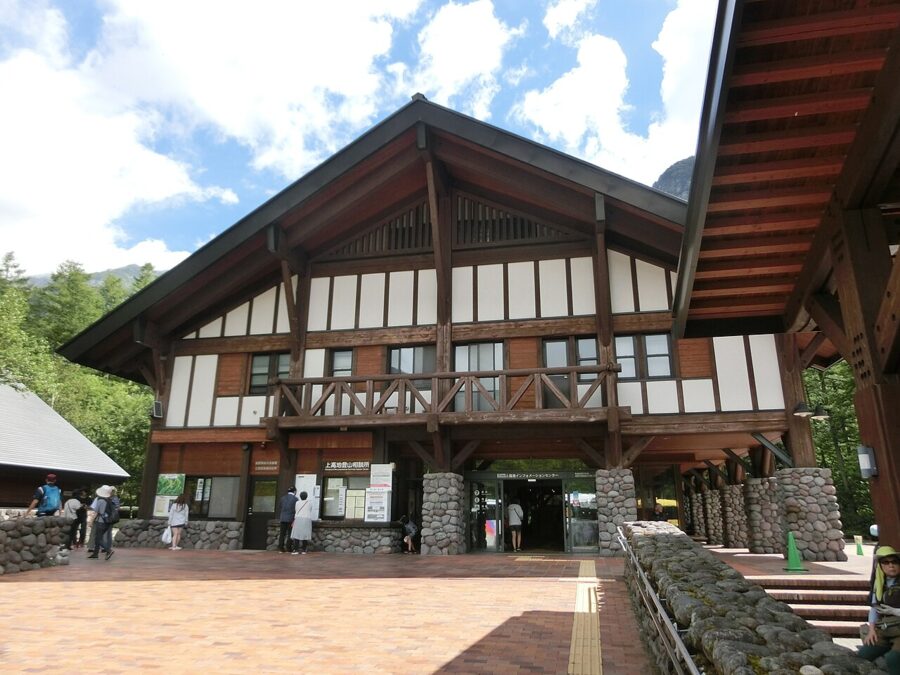
The official name for this stretch is the nature study trail, and it’s the best first walk in the valley. Get off the bus at the Taisho-ike stop and walk upstream towards the terminal. It’s about 4 km and takes 75 to 80 minutes without stops, which nobody manages.
After Tashiro-ike the trail splits into two. The Azusa course follows the river with Yakedake behind you; the forest course runs on boardwalks through the trees. The association suggests the forest course in spring, and I’d add: take the river course in autumn and the forest course in summer heat.
Taisho-ike
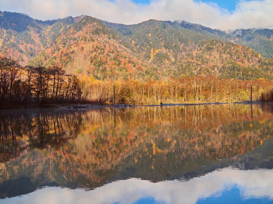
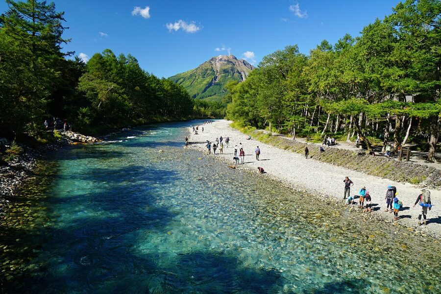
On 6 June 1915 Yakedake erupted and a mudflow dammed the Azusa. The water backed up over the forest and drowned it, and the dead trunks you see standing in the pond are what’s left of that forest more than a century later. Each year there are fewer of them.
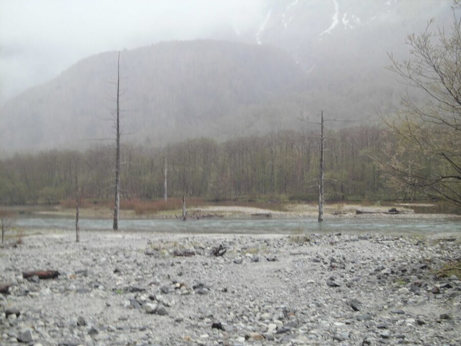
The pond is shallow and the mallards here don’t migrate; most don’t bother moving for people either. Come early: on a calm morning the reflection of the Hotaka ridge in the water is the shot everyone is up for, and the Taishoike Hotel’s lakeside restaurant opens at 7:00.
Tashiro-ike and the marsh
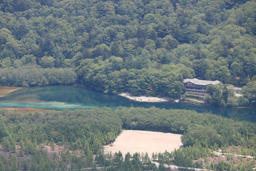
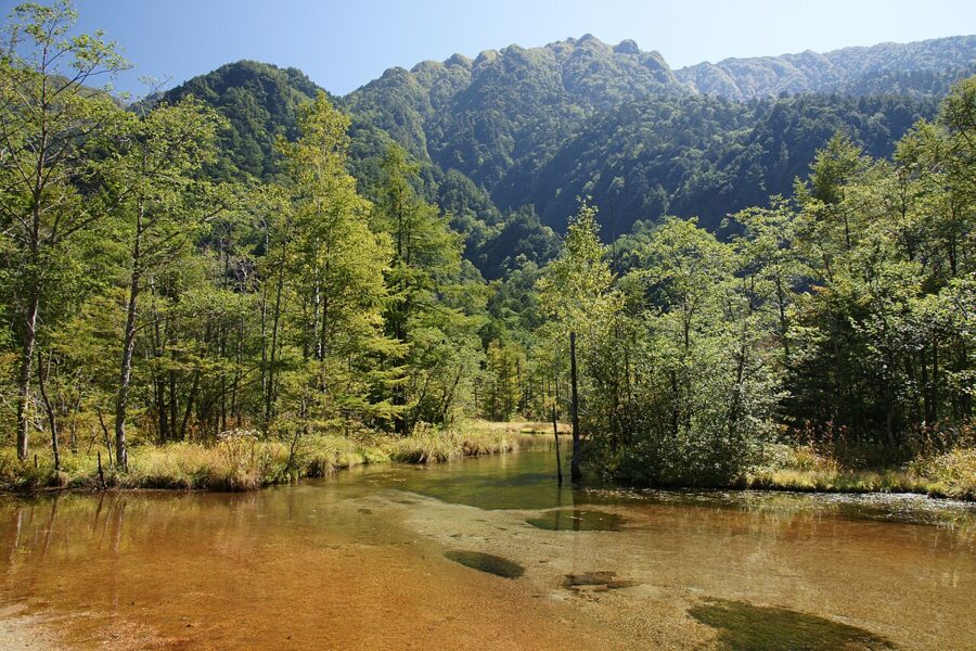
Twenty-five minutes on (1.2 km), the trail reaches Tashiro-ike, a shallow pond and wetland fed by springs off Kasumizawa-dake. The water is so clear you can see the iwana holding still on the bottom. Mid-June to early July the marsh fills with red Japanese azalea and white cotton-grass.
Walter Weston and the relief
Cross the Azusa at the Tashiro and Hotaka bridges and turn up the right bank. Ten minutes on, a relief portrait is set into a boulder among the trees: Walter Weston, an English missionary who climbed here in the 1890s. His 1896 book, Mountaineering and Exploration in the Japanese Alps, introduced these mountains to Britain and taught Japan to see climbing as a pastime rather than a pilgrimage or a job.
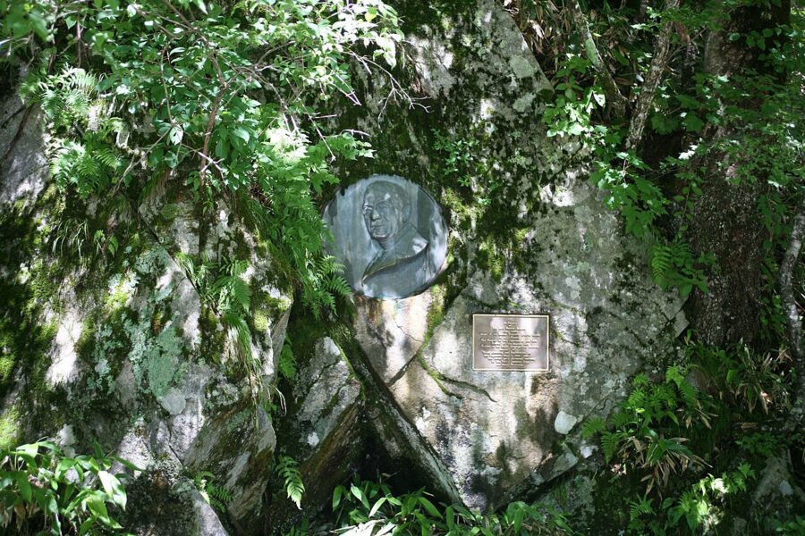
Japan calls Weston the father of modern Japanese mountaineering, and the Japanese Alpine Club holds the Weston Festival at the relief every year on the first Sunday in June. The 80th was on 7 June 2026, 10:00–11:30.
Kappa-bashi
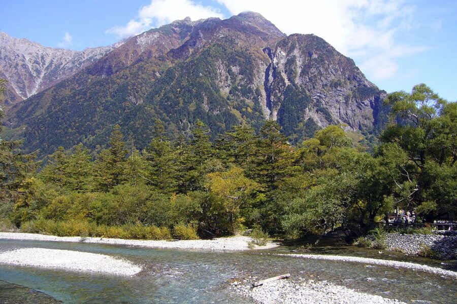
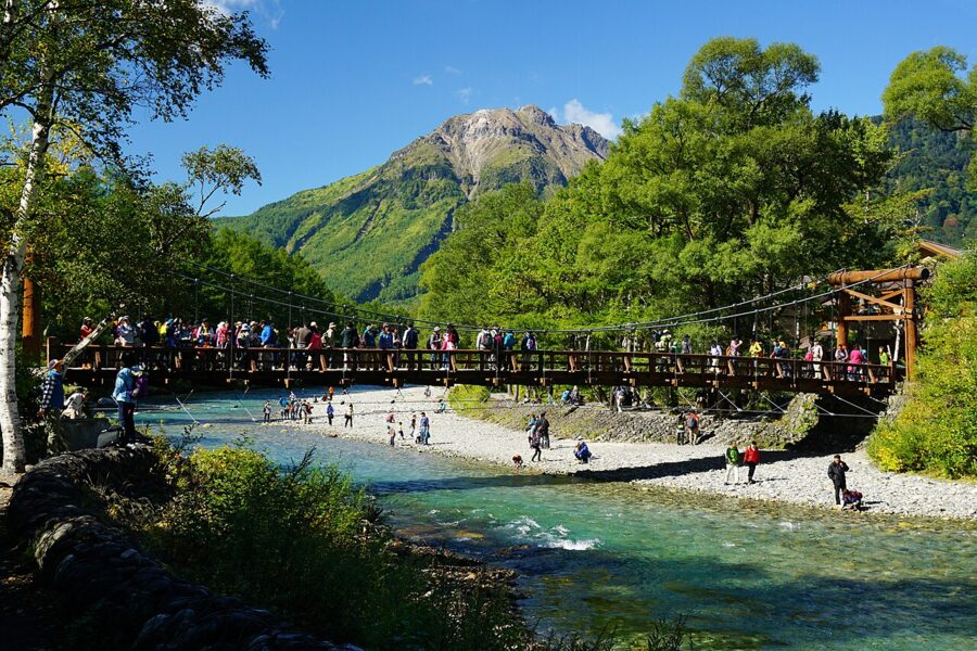
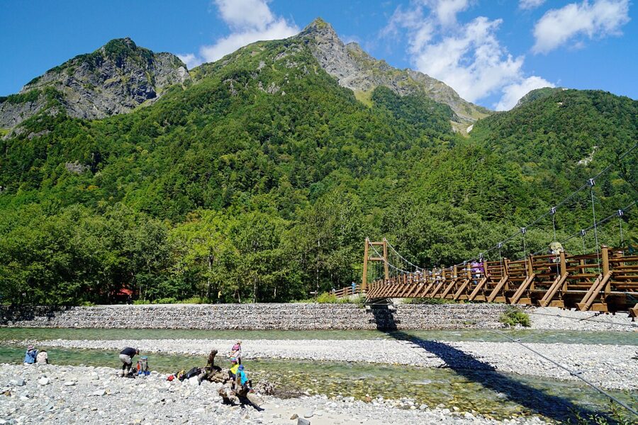
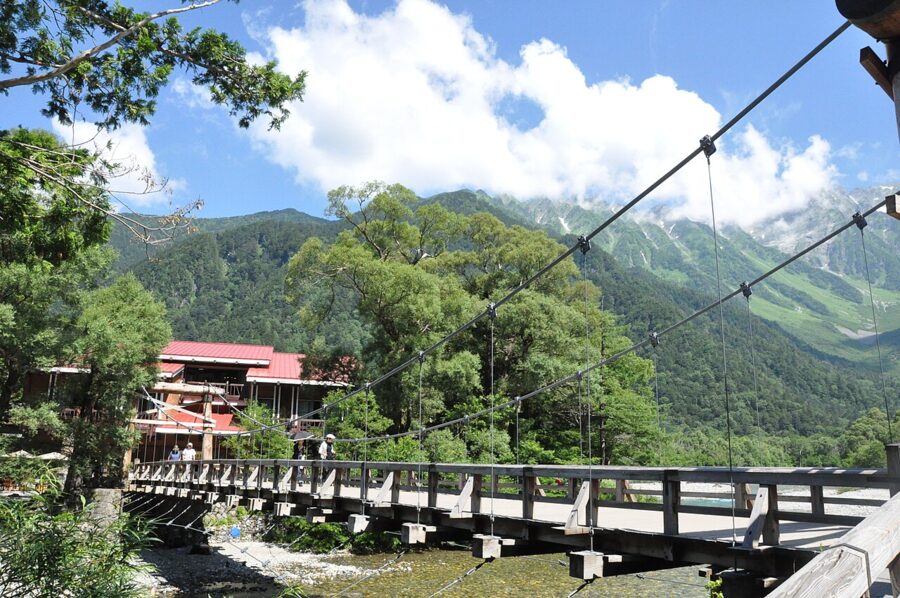
Twenty minutes past the relief (1.1 km) you reach the bridge. Kappa-bashi is a wooden suspension bridge about 37 metres long, and the current one is the fifth: the first suspension bridge replaced a log drawbridge in 1910, and today’s version went up in 1997. Nobody is sure about the name. One story says the pool here was deep enough for a kappa, a river imp; another says people wading across with their clothes piled on their heads looked like one.
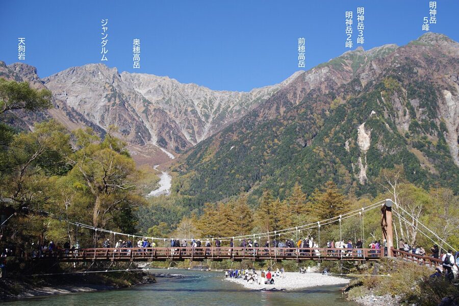
Upstream you get the Hotaka wall and Myojin-dake; downstream, the cone of Yakedake. That double view is why every postcard of Kamikochi is taken from these planks.
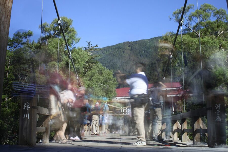
So don’t fight it. Cross, look, and come back for the photograph at 6:00 or after 17:00, when the day buses have gone. After dark the bridge is almost empty.
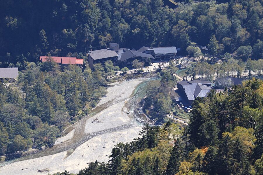
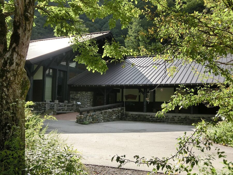
Just upstream on the left bank is the Kamikochi Visitor Center, run by the Ministry of the Environment. Its photographs and films are the quickest way to work out which peak is which, and it gives walking and climbing advice.
The walk to Myojin
From Kappa-bashi the valley runs another 3 km to Myojin, and there are paths on both banks. The right bank is longer (3.0 km, about an hour), quieter and has the views; the left bank, past the Konashidaira campsite, is quicker (2.5 km, about 50 minutes) and flatter. Go up the right bank and come back down the left, and you’ve done the classic two-hour loop the association recommends.
Dakesawa marsh
Ten minutes upstream on the right bank, a boardwalk crosses Dakesawa marsh. The water is clear and still, with dead trees standing in it, and the boardwalk looks straight up the Dakesawa gully towards the Hotaka peaks. Japanese azalea and day lilies flower here in early summer.
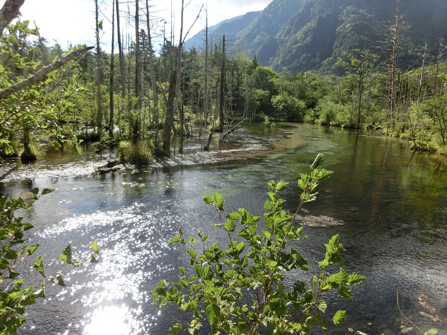
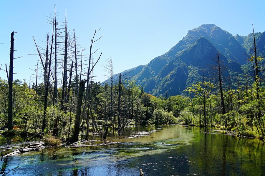
The next 2 km to Myojin are forest, with gaps that open on Roppyakusan and the river. These quieter forest stretches are bear country; more on that below.
Myojin-ike and the inner shrine
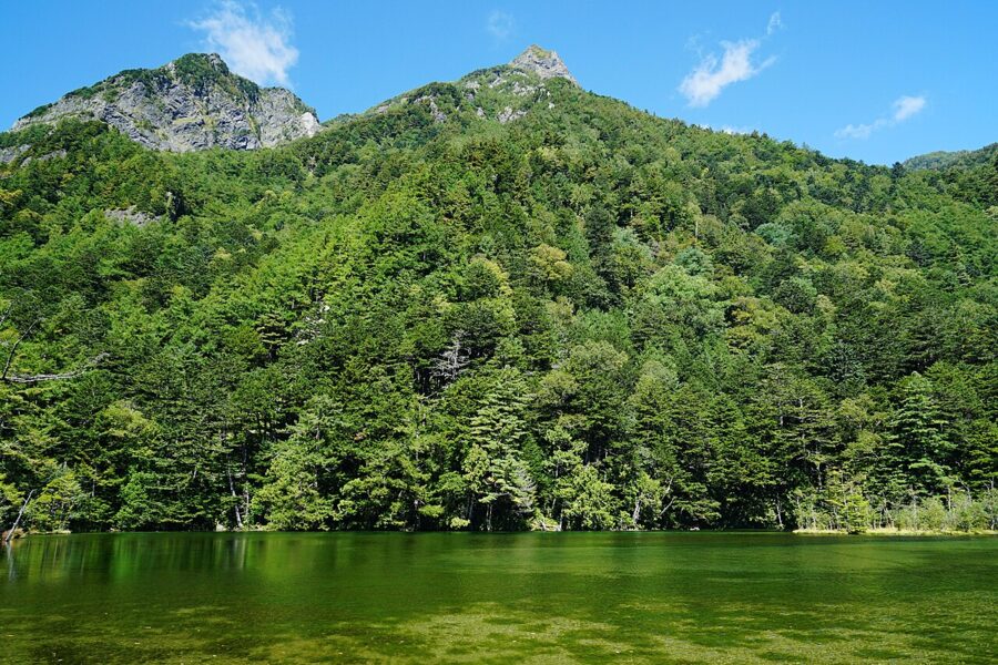
The right-bank path brings you straight to the pond; Myojin-bashi links it to the left bank and Myojinkan. Myojin-ike sits inside the grounds of the inner shrine, the Okumiya, of Hotaka Shrine, whose main shrine is down in Azumino. The pond is a shrine precinct, so there’s an entry fee: ¥500 for adults and ¥200 for primary-school children, 6:00–17:00 during the season.
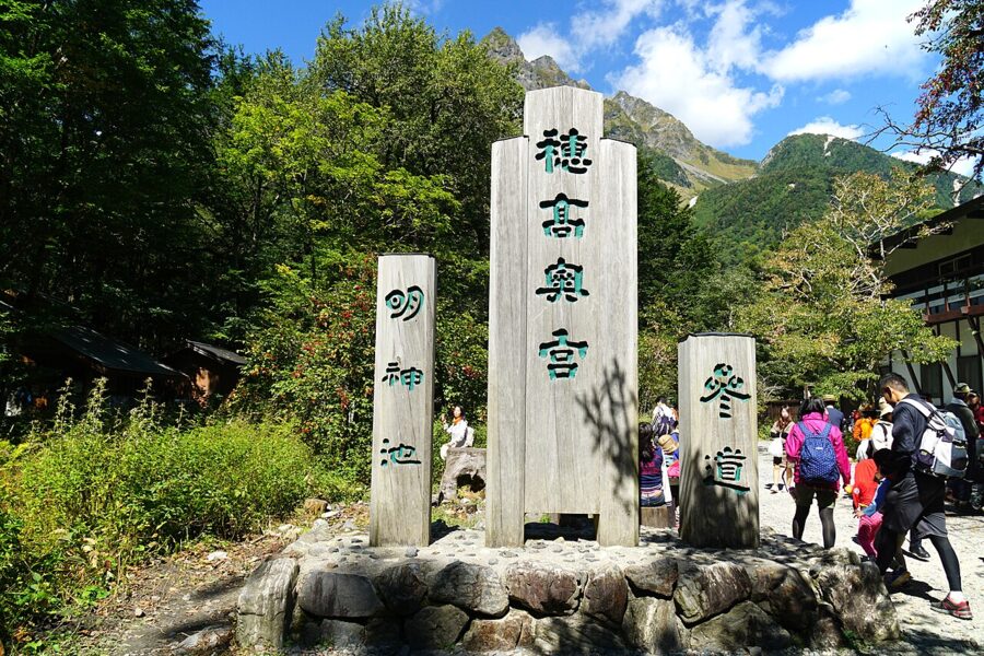
The pond is gourd-shaped, split into Ichi-no-ike and Ni-no-ike, and it was formed by a landslide off Myojin-dake. It’s fed by underground springs and is known for never freezing. There used to be a third pond further back, lost to another landslide. Look for iwana and mallards, and for a rare water plant the shrine points out, ichobaigamo.
Kamonji and his hut
Right beside the path to the shrine is a low wooden hut with smoke coming out of the roof. Kamijo Kamonji (1847–1917) was a woodcutter and hunter who lived up here, taking iwana in summer and serow and bear in winter. He built his hut by the pond in 1880. In 1893 he guided Weston up Mae-Hotaka, and Weston’s book made him famous as “Mr Kamonji”.
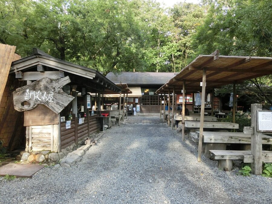
I’ll come back to the fish in the food section. For coffee instead, Café de Koisho at Yama no Hidaya, just off the right-bank path near the pond, does its own roast coffee and daily cakes, 9:00–15:00, closed Wednesdays and Thursdays.
On to Tokusawa
Beyond Myojin the valley empties. The path to Tokusawa stays on the left bank, 3 km and about an hour, flat but long enough that you’ll want water and a layer. Myojin-dake stands on your left the whole way, and when the north ridge and the east face of Mae-Hotaka appear ahead on the right, you’re nearly there.
Tokusawa was the biggest of the old ranches, and it still looks like one: a wide meadow under elm and katsura trees. In early June it’s covered in white nirinso anemones and the small wild apple trees called konashi are in flower. It’s the most open, sunny place in the valley and the one I’d spend an afternoon in.
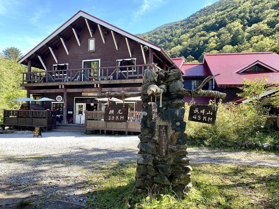
The lodge’s Michikusa canteen opens 7:30–15:00 and is known for one thing: its soft-serve and coffee soft-serve, which draw a queue out the door at the height of summer. Its curry, made with spices bought from Nepal, is the other draw. Tokusawa also has a summer clinic run by Nihon University’s medical school.
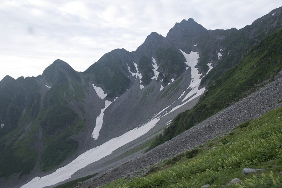
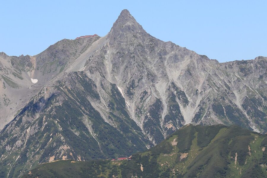
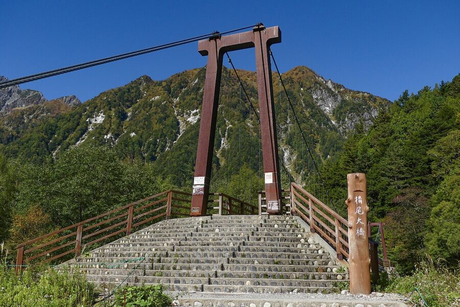
Past Tokusawa, the valley path runs another 3.5 km (about 70 minutes) to Yokoo, where the walk ends and the climbing begins. Yarigatake (3,180 m) is up the Yari valley to the left; the Hotaka peaks and Karasawa are over the bridge to the right. Both need hut bookings and mountain gear, and both are in a zone where helmets are recommended. This guide stops at the bridge.
Bears, monkeys and the weather
Kamikochi looks tame because the paths are good. It isn’t, and the rules are short.
Bears
The valley is Asiatic black bear country. There have been attacks in the valley in recent years, including one on a camper at Konashidaira in 2020, and sightings have closed sections of path for a time. Most bears avoid people; the dangerous ones have learned that people mean food. The Ministry of the Environment’s leaflet for Kamikochi puts it bluntly: don’t teach bears that there’s food near people.
So carry a bell or talk as you walk on the quieter stretches, especially beyond Myojin and early or late in the day. Never leave food, rubbish or empty cans outside, even for a minute. At the campsites, use the food lockers; Konashidaira bans barbecues for this reason.
Check the park notices on the official Kamikochi site before you set off, since sections of path have been closed after bear activity. If you see a bear, keep your distance and move away calmly.
Monkeys and ducks
Japanese macaques live in the valley all year. Winters here are colder than on the Shimokita Peninsula in Aomori, home of the troop usually called the northernmost monkeys in the world. Unlike the snow monkeys at Jigokudani, which have a park built around their bath, these troops live entirely wild, and feeding them is against the park rules.
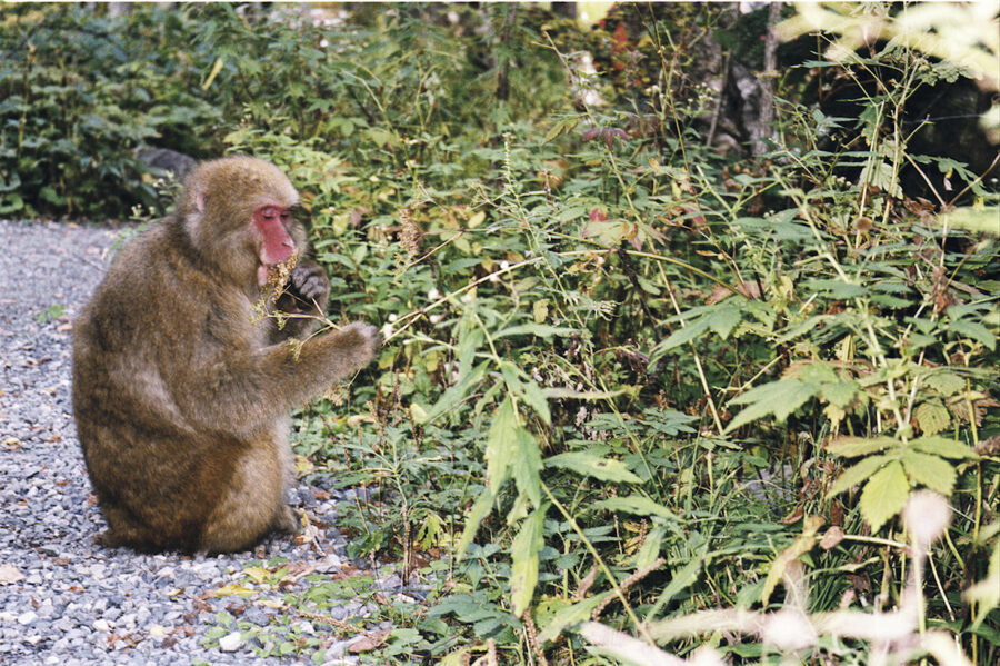
The other rules: don’t pick plants or catch insects, take all rubbish home (there are almost no bins), no pets, stay on the paths, no bicycles on the trails and no drones. Most public toilets ask for a tip in a box at the door.
Weather and what to wear
Kamikochi averages 5–10°C colder than Matsumoto. These are the 2022 average daily highs and lows from the Ministry of the Environment’s Visitor Center, as published by the tourism association.
| Month | Average high | Average low | What to bring |
|---|---|---|---|
| Late April | 13.7°C | 2.2°C | Down jacket, gloves, hat |
| May | 16.2°C | 4.7°C | Fleece and a windproof |
| June | 20.0°C | 10.0°C | Rain jacket |
| July | 23.0°C | 13.7°C | Long sleeves for the evening, sun hat |
| August | 21.7°C | 15.4°C | As July |
| September | 20.0°C | 12.1°C | Fleece |
| October | 12.5°C | 3.6°C | Down jacket, gloves |
| Early November | 8.9°C | −1.1°C | Winter layers, frost on the boardwalks |
From Taisho-ike to Yokoo, ordinary walking shoes or trainers are fine; after rain, waterproof shoes are better on puddled gravel and slick boardwalks. Carry rain gear even when it’s sunny.
Bring cash. There’s no bank and no ATM in Kamikochi, and the post office doesn’t do withdrawals, though plenty of hotels and shops take cards. Phone signal is reliable around Kappa-bashi, the bus terminal, the Weston relief, Tashiro-ike and Taisho-ike. There’s a Tokyo Medical University clinic next to the terminal.
Where to sleep in the valley
Staying over changes Kamikochi more than anything else you can do. By early evening the day visitors have gone, the road gate shuts at 19:00, and you get the bridge in the evening and the ponds at dawn.
The catch is supply: fewer than 20 places to stay, from a 74-room hotel to a four-room hut, plus two campsites, and autumn weekends sell out months ahead. Prices below are from each property’s 2026 listing with the tourism association.
The Kamikochi Imperial Hotel
Japan’s first true mountain resort hotel opened on 6 October 1933, built by the company behind Tokyo’s Imperial Hotel. Materials came up through the Kama Tunnel to Taisho-ike and crossed the pond by boat. The present building dates from 1977 but kept the red triangular roofs and log-cabin look of the original, and it sits in the trees between Taisho-ike and Kappa-bashi, a little way from the bridge, with its own bus stop.
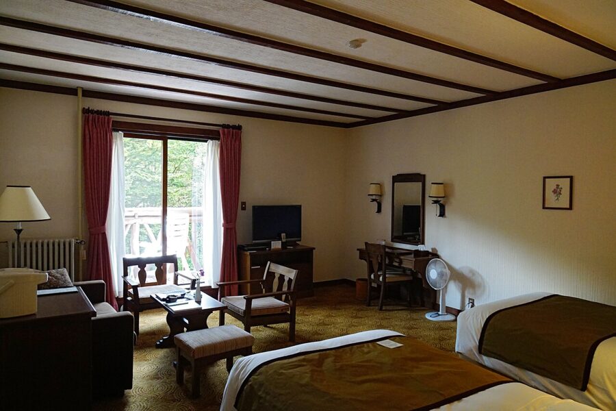
The thing people remember is the fireplace. When the daytime temperature stays below 15°C, which is most of the season outside summer, a bellman lights it in the lobby at 17:00. Bookings for 2027 open on the hotel’s site on 9 February 2027 at 10:00, and the hotel runs from late April to mid-November.
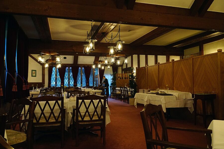
By the bridge
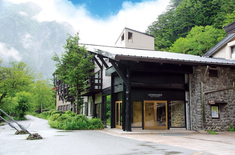
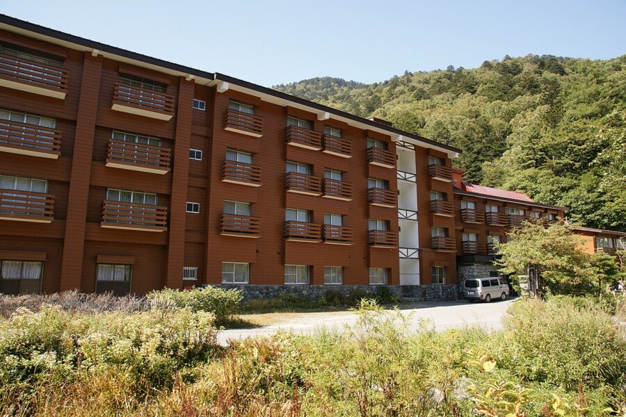
Gosenjaku Hotel Kamikochi started as an inn in 1918 and stands right at Kappa-bashi, with 28 rooms; the fourth-floor balconies look straight at the bridge and the Hotaka ridge. In 2026 it started at ¥36,960 per person with dinner and breakfast. The food is French-based, but the pork-miso soup at breakfast is a recipe from the opening year.
For a mid-range bed, Nishi-Itoya Mountain Lodge, two minutes from the bridge on the right bank, has run since 1928 and has both private rooms (¥13,000–23,000 per person with two meals in 2026) and a shared-room annex for ¥11,000–13,000. Climbers bound for Yari and Hotaka have used it for generations.
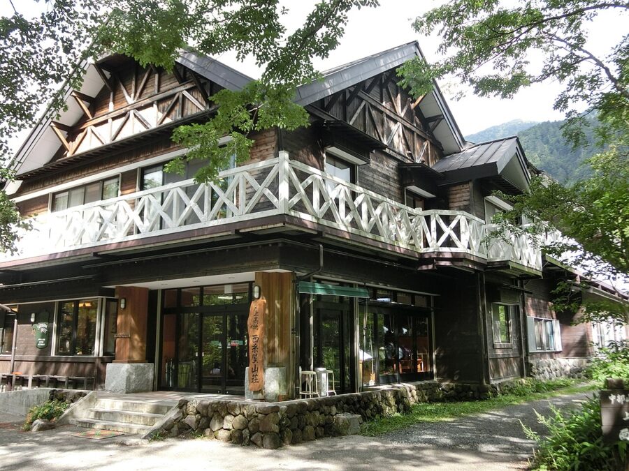
The valley has its own hot spring, and the Kamikochi Onsen Hotel, the first big building you reach on the right bank after the Tashiro bridge, is named for it. If this is your first trip to a hot-spring inn, my onsen and ryokan guides cover the bathing rules and how dinner and breakfast work.
Up the valley
Myojinkan, by Myojin-bashi, may be the oldest site in the valley: its predecessor was a Matsumoto-domain hut used for the logging, and Weston is recorded as staying there. In 2026 a bed in a shared room was ¥11,000 with two meals, and private rooms were ¥15,000–18,000 per person for two sharing. Its canteen opens at 7:00, the earliest around Myojin.
Kamonjigoya has four rooms, all private, with dinner and breakfast included whether you want them or not. Bookings are online only, on the hut’s own site, and open for 2027 at 11:00 on 1 March 2027, for stays from 27 April; groups of three or more can book 90 days ahead, pairs 60 days and solo travellers 30 days. From 2027 it no longer takes children under three, because everyone has to walk an hour from the bus terminal.
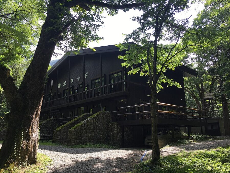
At Tokusawa, Tokusawaen starts at ¥17,600 per person with two meals, with private rooms and a shared room built like a honeycomb of bunks, and the city-run Tokusawa Lodge starts at ¥12,000.
Camping
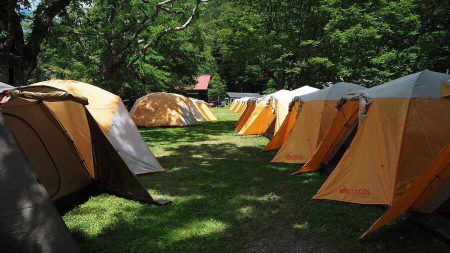
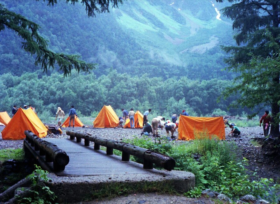
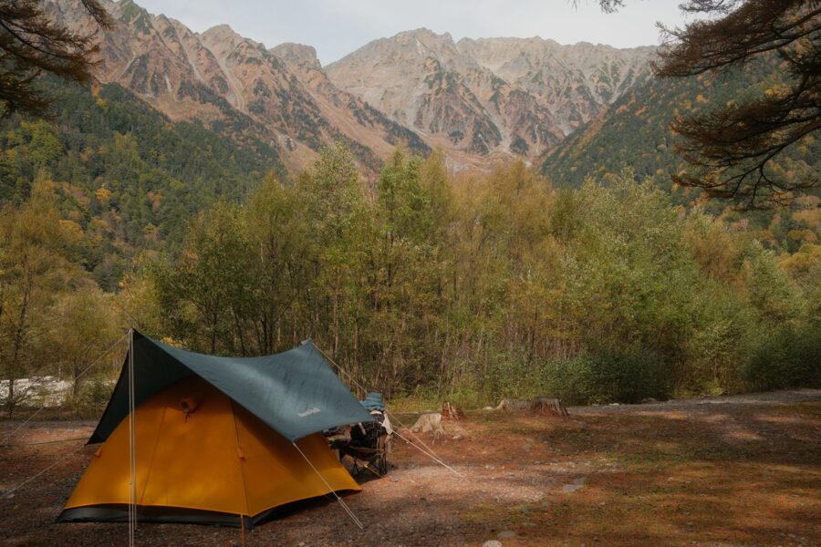
Konashidaira, ten minutes upstream of Kappa-bashi on the left bank, is the big campsite: twelve tent areas, cabins and a shop that sells food and gear. In 2026 a tent pitch was ¥2,000 per adult per night, cabins started at ¥6,000 per person, and anyone could use the bath for ¥1,000. It also keeps bags for ¥300 a day.
What to eat
Nobody comes to Kamikochi for the food, and most of it is the plain, pricey fuel you’d expect at 1,500 metres. Three things are worth planning around: the char at Kamonjigoya, the curry at the Imperial Hotel, and the soft-serve at Tokusawa.
Iwana at Kamonjigoya
Inside Kamonjigoya, iwana char are skewered whole and stood around the irori hearth, where they grill slowly over the wood fire until the whole fish, head to tail, can be eaten. The fish come from a holding pen in the stream outside, scooped out just before they go on the skewer.
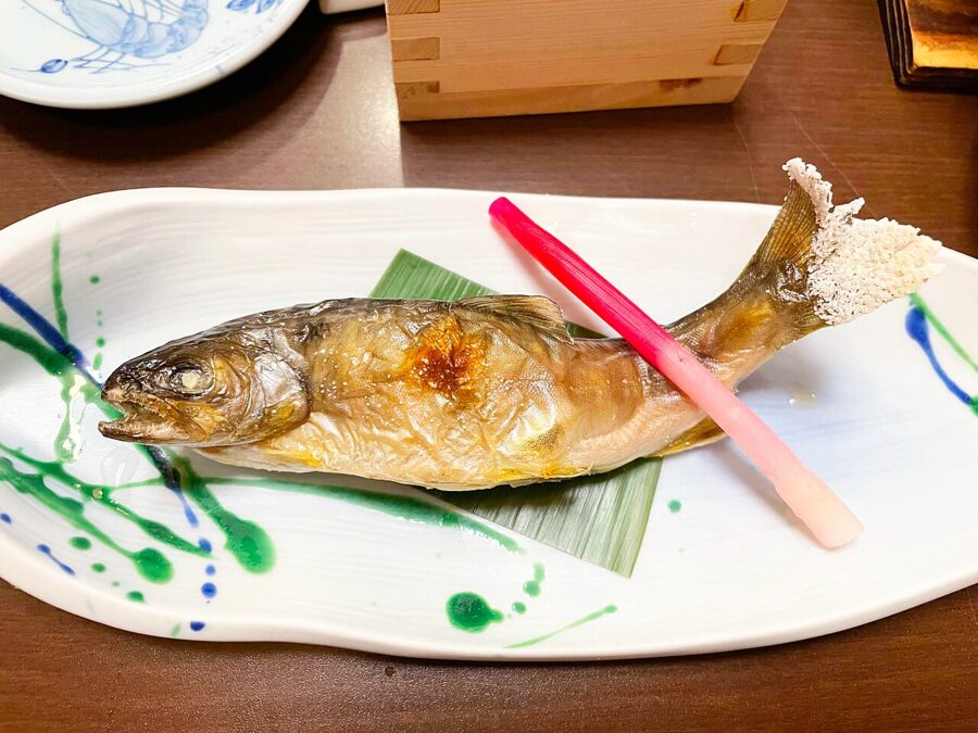
The 2026 menu: iwana shioyaki on its own ¥1,500, or as a set with rice, miso soup, pickles and a side for ¥2,300. Kamonji soba (¥1,700) comes topped with a sweet-simmered iwana you also eat whole. For something stronger there’s kotsuzake (¥2,000): an iwana smoked for about three days in the hearth smoke, with hot sake from the hut’s own label poured over it.
The canteen serves 10:00–14:00 and takes no reservations, so aim for 10:30 or after 13:00. Iwana is one of the classic river fish of the Japanese mountains, and the bone version is a decent excuse to start on sake before noon.
One footnote. Brook trout and brown trout have been released into the Azusa since 1925, and hybrids with the native iwana now live in the river. Fishing it has been banned since 1975.
The hotel curry
The Imperial Hotel’s Alpenrose restaurant (11:00–14:30, last order 14:00) is the one smart lunch in the valley, and its best seller is the hotel’s traditional beef curry at ¥3,800. The omelette rice with hashed beef (¥3,900) is only served here, not at the Tokyo hotel. It’s the old Western-hotel style of Japanese curry, the kind the big Tokyo hotels made famous.
Is it worth ¥3,800? Once, on a cold day, yes. The Grindelwald lounge does a cake set for ¥2,600 (10:00–16:00) and a custard pudding set limited to 20 a day.
If that feels mad, the Kamikochi Shokudo canteen above the bus terminal, open from 6:00, does a beef curry for ¥1,100 and a set with grilled iwana and soba for ¥1,950. Myojinkan’s curry was ¥1,000.
Apple pie, soft-serve and kappa-yaki
Kamikochi Hotel Shirakabaso, at the bridge, runs the La Belle Foret terrace, with an unobstructed view of the Hotaka ridge. It does its own apple pie (¥600) and seasonal cakes (¥700), and serves Kamikochi Beer, a local craft beer, for ¥1,390.
The other snacks are a Kamikochi soft-serve (Tokusawaen’s is the famous one) and kappa-yaki, a taiyaki-style cake shaped like a kappa instead of a fish, baked at the shop on the ground floor of the bus terminal. Nagano apple juice is on almost every menu.
Shinshu soba on the way
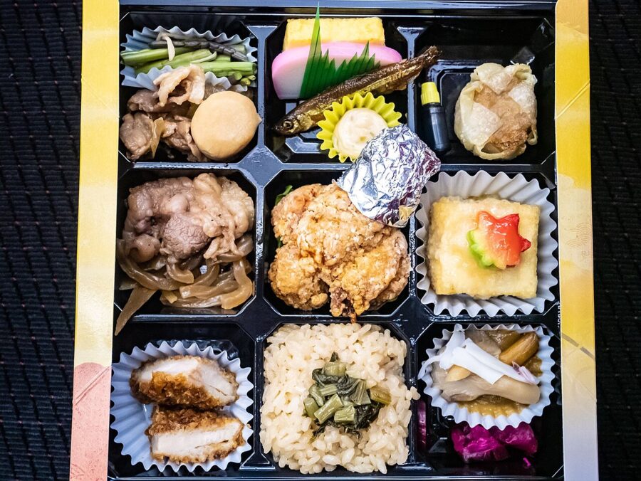
You’ll pass through soba country to get here. Nagano is famous for it, and a bowl of Shinshu soba in town is the obvious lunch before or after the bus.
When to go
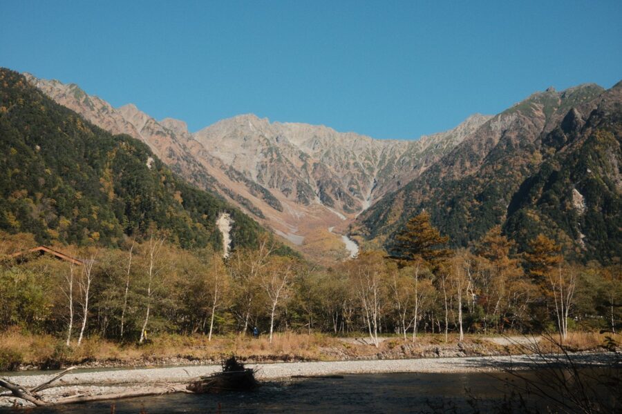
The tourism association’s own picks are fresh green from late May to early June, flowers in July and August, and autumn colour from early to late October. I’d add a fourth: the last fortnight, in early November, if you don’t mind the cold.
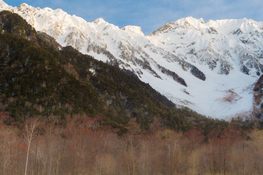
Late April to May. The peaks are still white, the larches bare, and the opening festival is on 27 April. It’s cold and some inns open late, but the snow on Hotaka is at its best.
Late May to June. New larch green against old snow, nirinso at Tokusawa in early June and the Weston Festival on the first Sunday. The association points out that June rainfall here is comparatively low and the crowds are thin.
July and August. Highs around 22–23°C make this the coolest place most people visit in a Japanese summer. It’s also the busiest stretch: Saturdays, Sundays, holidays and the Obon week in mid-August are the days to avoid if you can.
October. The larches turn gold, the boat festival happens on 8 October, and so does everyone else. Go midweek, stay the night, or both.
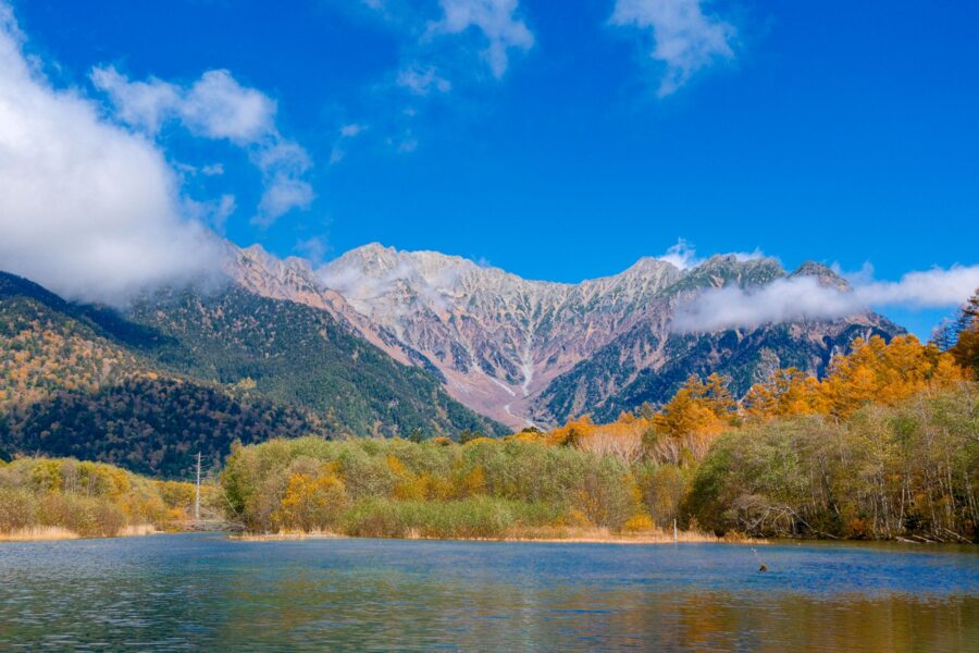
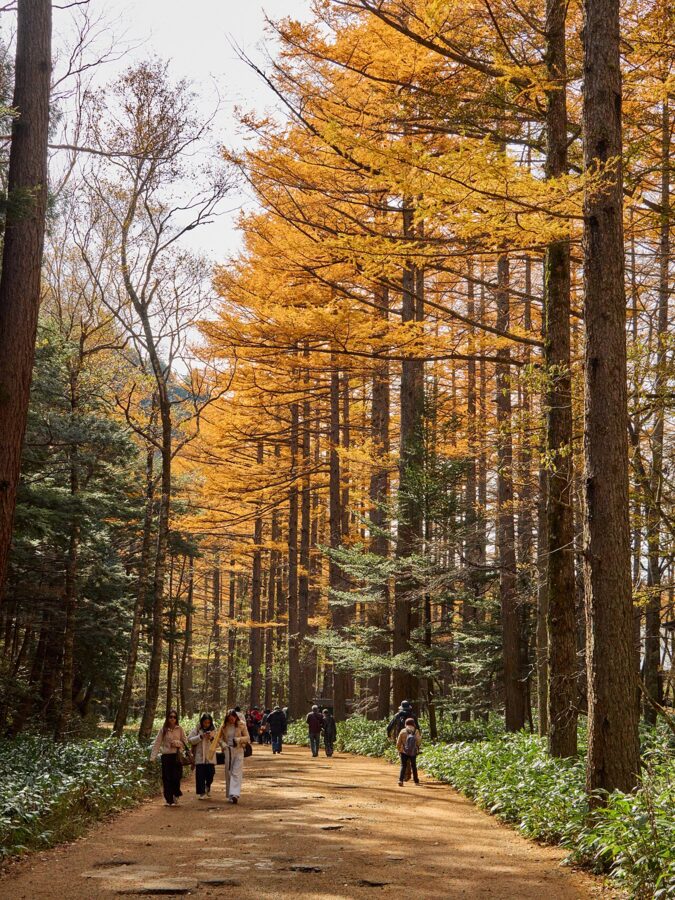
Early to mid-November. Facilities shut one by one and the larches are at their end. The closing ceremony is on 15 November at 11:30 by Kappa-bashi, with a sake barrel opened at noon, and the next morning the gate stays shut.
A day in Kamikochi, timed
This assumes you slept in Matsumoto and booked your bus seats a month ahead. Times are from Alpico’s 2026 timetable, so check the 2027 one before you go.
- 7:15 Kamikochi Line train from Matsumoto, arriving Shin-Shimashima 7:49.
- 8:00 Bus from Shin-Shimashima. Get off at Taisho-ike at 8:54, not at the terminal.
- 9:00–10:30 Taisho-ike, Tashiro-ike, the Weston relief and Kappa-bashi, on the river course.
- 10:30 Up the right bank past Dakesawa marsh.
- 11:30 Myojin-ike and the inner shrine (¥500), then early lunch at Kamonjigoya before the noon queue.
- 13:00 Back down the left bank via Konashidaira, about 50 minutes.
- 14:00 Cake or curry at the bridge, the Visitor Center, a last look from Kappa-bashi.
- 15:15 or 16:00 Bus back down to Shin-Shimashima and the train to Matsumoto.
That’s about 10 km of flat walking. If you’d rather swap the ponds for Tokusawa, skip Taisho-ike, ride to the terminal and go straight up the left bank; you’ll reach the soft-serve by about 11:00.
An overnight, which is what I’d do
Arrive after lunch and do the Taisho-ike walk in the afternoon, when the light comes over Yakedake behind you. Check in, and go back out to the bridge after 17:00, when the last day buses have gone. If you’re at the Imperial Hotel, the fireplace is lit at the same time.
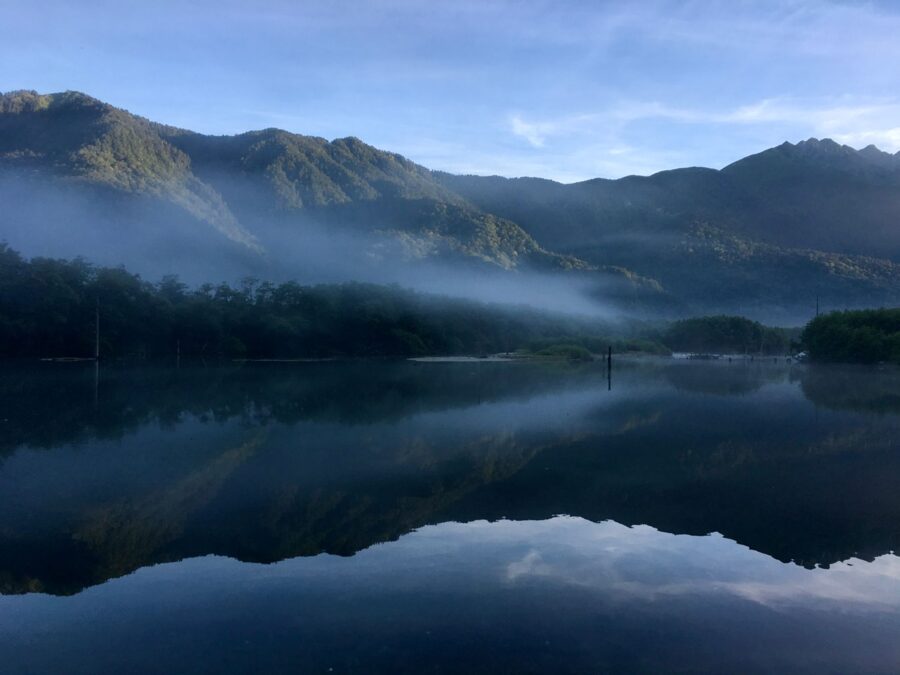
Next morning, be at Myojin-ike when the shrine gate opens at 6:00 and have the pond to yourself. Walk on to Tokusawa for coffee, take the left bank back for an early lunch at the bridge, and catch a bus out in the early afternoon. Two days, two different valleys.
Norikura, Shirahone and the Shinhotaka Ropeway
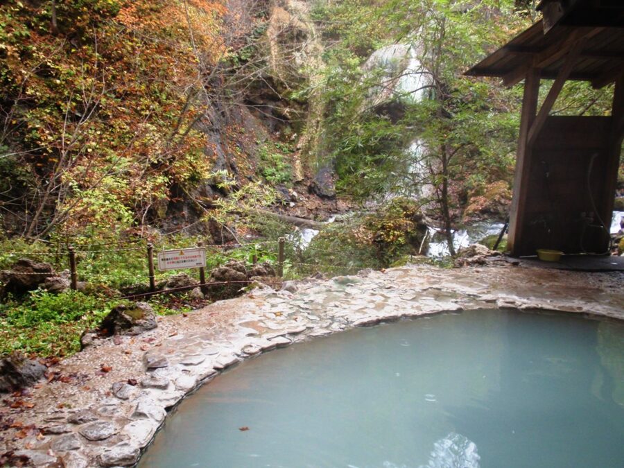
Since 1 September 2026 Alpico has run a reservation-priority connecting bus from Kamikochi (platform 6) to the Sawando bus terminal, where you change for Shirahone Onsen or Norikura Kogen. Shirahone’s milky water is the best soak within reach of the valley.
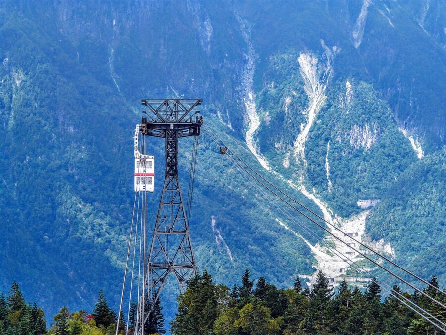
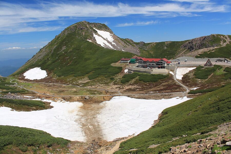
Norikura is the high peak you can reach by bus: Alpico runs up to the Tatamidaira terminal below the summit from Norikura Kogen on the Nagano side, and Nohi from Hirayu on the Gifu side. From Hirayu, the Shinhotaka Ropeway runs Japan’s only double-decker gondolas up to 2,156 metres, with Yarigatake and the back of the Hotaka range in front of you.
For a very different forest walk, the cedar trails of Yakushima are the other national park I’d put on the same list. But they’re a flight away. Norikura is a bus.
What it costs
These are adult prices for the 2026 season, from the operators and venues. Expect small changes for 2027.
| Item | Price | Note |
|---|---|---|
| Matsumoto to Shin-Shimashima, Kamikochi Line | ¥710 | About 30 min |
| Shin-Shimashima to Kamikochi, bus | ¥3,100 one way | About 65 min, reservation-priority |
| Matsumoto Bus Terminal to Kamikochi, National Park Liner | ¥4,600 (¥5,000 on the 5:30) | About 90 min |
| Sawando to Kamikochi, shuttle | ¥1,600 / ¥3,000 return | Parking ¥800 a day |
| Hirayu or Akandana to Kamikochi, shuttle | ¥1,500 / ¥2,800 return | Akandana parking ¥600 a day |
| Takayama to Hirayu Onsen, Nohi Bus | ¥1,600 | About 1 hour |
| Taxi, upper Sawando to the bus terminal | ¥5,400 | Fixed fare, standard taxi |
| Myojin-ike entry | ¥500 | 6:00–17:00 |
| Iwana shioyaki, Kamonjigoya | ¥1,500 | Set meal ¥2,300 |
| Beef curry, Imperial Hotel Alpenrose | ¥3,800 | Canteen curry ¥1,000–1,100 |
| Campsite, Konashidaira or Tokusawa | ¥2,000 | Per adult per night |
| Imperial Hotel | from ¥49,500 | Per room, no meals |
Skip this
- Driving to Sawando mid-morning on an October weekend. You’ll spend the best light in a shuttle queue. Go early or come by train.
- Photographing Kappa-bashi at midday. Cross it, enjoy it, and come back at 6:00 or after 17:00 for the picture.
- The Kamikochi Line day pass. It costs exactly two single fares. Only worth it if you’re stopping along the line.
- Tokusawa as a same-day return from Tokyo by train. You’ll spend the whole walk checking your watch. Sleep in Matsumoto, or in the valley.
- Assuming everything is open in November. Several cafés and huts close in the first week. Check before you build a plan around one.
Book the bus home before you book anything else. Wear shoes you’ve walked in, carry cash and a rain jacket, and keep your lunch in your bag. Then get off at Taisho-ike, turn your back on the volcano, and walk upstream until the bridge comes into view.
You Might Also Enjoy
 China Travel Tips for 2026: Visa-Free Entry, Paying With Your Phone, Apps, Trains and What First-Timers Get Wrong
 The Yakitori Guide: Every Cut, Every Tare, Every Counter Worth Sitting At
 Phuket Food Guide: Sino-Portuguese Old Town, Moo Hong, and the Southern Thai Kitchen
 Tokyo’s Best Neighbourhoods for Eating Out